Browse
Big Creek Road, Between State Route 284 & Big Creek Campground, Gatlinburg, Sevier County, TN. Library of Congress Prints and Photographs Division: Historic American Engineering Record.
Businesses on Tennessee Highway 71 at Le Conte Creek, 1938. National Archives and Records Administration, Atlanta: Kodak Negative File, 1938.
Cades Cove Road & Laurel Creek Road, From Townsend Wye to Cades Cove, Gatlinburg, Sevier County, TN. Library of Congress Prints and Photographs Division: Historic American Engineering Record.
Cataloochee Valley Road, Cataloochee Valley, Gatlinburg, Sevier County, TN. Library of Congress Prints and Photographs Division: Historic American Engineering Record, Undated.
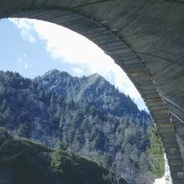
The Chimneys from the highway bridge.. The University of Tennessee Libraries Digital Collections: Albert Gordon "Dutch" Roth Digital Photograph Collection, 1941.
Chimneys from the tunnel. Special trip to the Chimneys.. The University of Tennessee Libraries Digital Collections: Albert Gordon "Dutch" Roth Digital Photograph Collection, 1940.
Clingmans Dome Road, Between Newfound Gap Road & Clingmans Dome, Gatlinburg, Sevier County, TN. Library of Congress Prints and Photographs Division: Historic American Engineering Record.
Cosby Park Road, Between State Route 32 & Cosby Campground, Gatlinburg, Sevier County, TN. Historic American Engineering Record, Undated.
Cosby Park Road, contact station at campground. Library of Congress Prints and Photographs Division: Historic American Engineering Record, 1996.
Cosby Park Road, entrance sign. Library of Congress Prints and Photographs Division: Historic American Engineering Record, 1996.
Cosby Park Road, stream view. Library of Congress Prints and Photographs Division: Historic American Engineering Record, 1996.
Design Principles - Great Smoky Mountains National Park Roads & Bridges. Library of Congress Prints and Photographs Division: Historic American Engineering Record, 1996.
Evolution of Major Roads - Great Smoky Mountains National Park Roads & Bridges. Library of Congress Prints and Photographs Division: Historic American Engineering Record, 1996.
Foothills Parkway, From Chilowee to Walland & from Cosby to I-40, Gatlinburg, Sevier County, TN. Library of Congress Prints and Photographs Division: Historic American Engineering Record.
From road on the way to Richland Balsam hike.. The University of Tennessee Libraries Digital Collections: Albert Gordon "Dutch" Roth Digital Photograph Collection, 1939.
From the old road to Mount Mitchell.. The University of Tennessee Libraries Digital Collections: Albert Gordon "Dutch" Roth Digital Photograph Collection, 1931.
Gatlinburg Entrance to Pi Beta Phi School.. The University of Tennessee Libraries Digital Collections: From Pi Beta Phi to Arrowmont, 1925.
Great Smoky Mountains National Park Roads & Bridges, Deep Creek Road, Between Park Boundary near Bryson City & Deep Creek Campground, Gatlinburg, Sevier County, TN. Historic American Engineering Record.
Great Smoky Mountains National Park Roads & Bridges, Roaring Fork Motor Nature Trail, Between Cherokee Orchard Road & U.S. Route 321, Gatlinburg, Sevier County, TN. Historic American Engineering Record.
Great Smoky Mountains National Park Roads & Bridges, The Loop Over Bridge, Newfound Gap Road 8.6 miles from park entrance, Gatlinburg, Sevier County, TN. Historic American Engineering Record.
Great Smoky Mts. From road over Scott Mt.. The University of Tennessee Libraries Digital Collections: William Cox Cochran Great Smoky Mountains Photographic Collection, 1886.
Heintooga Round Bottom Road & Balsam Mountain Road, Between Blue Ridge Parkway & Big Cove Road, Gatlinburg, Sevier County, TN. Library of Congress Prints and Photographs Division: Historic American Engineering Record.
Highway under construction at Indian Gap.. The University of Tennessee Libraries Digital Collections: Albert Gordon "Dutch" Roth Digital Photograph Collection, 1934.
Indian face over Little River Road. Rock face over highway above Townsend.. The University of Tennessee Libraries Digital Collections: Albert Gordon "Dutch" Roth Digital Photograph Collection.
Indian Gap. Indian Gap highway in background. Made from the side of Mount Mingus.. The University of Tennessee Libraries Digital Collections: Albert Gordon "Dutch" Roth Digital Photograph Collection, 1947.

